Urban Design Media: Emerging Media
In this course, students collect local or global data and apply mapping skills, including using ArcGIS and Illustrator, to map local experience and large-scale urban systems and use spatial data science to make inferences.
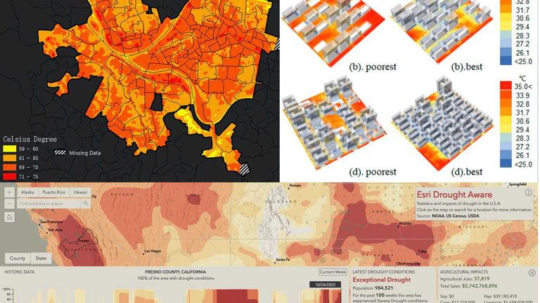
1) Land Surface Temperature Extraction, 2) Outdoor Thermal Comfort Simulation, 3) Dashboard Design (ESRI).
As urban development takes over natural lands, the climate crisis is a challenge for both urban design and related policy making. This requires not only advanced analysis support through data inferencing to reveal real-world problems but also mapping techniques to showcase the story to stakeholders. In this course, students collect local or global data and apply mapping skills, including using ArcGIS and Illustrator, to map local experience and large-scale urban systems and use spatial data science to make inferences. Advanced ArcGIS skills may also be introduced, including raster imagery analysis and/or using Python (in ArcGIS Notebook) for machine learning to identify urban built environment issues — including urban heat island, flooding risks and social inequity — to provide evidenced-based mapping interface for decision making. The course also introduces parametric urban design using Ladybug 3D analysis for outdoor design optimization. The course has both lectures and labs with hands-on exercises to learn from case studies and prepare students for their final projects on topics of their own interests.
Students are required to take the introductory ArcGIS course before taking this advanced level media course. Basic mapping skills with ESRI ArcGIS Pro and online dashboard design skills are required.